
Carroll County, Arkansas
Carroll County | |
|---|---|
 Carroll County Courthouse in Berryville | |
 Location within the U.S. state of Arkansas | |
 Arkansas's location within the U.S. | |
| Coordinates: 36°22′05″N 93°29′47″W / 36.368055555556°N 93.496388888889°W | |
| Country | |
| State | |
| Founded | November 1, 1833 |
| Named after | Charles Carroll |
| Seat | Berryville and Eureka Springs |
| Largest city | Berryville |
| Area | |
• Total | 639 sq mi (1,660 km2) |
| • Land | 630 sq mi (1,600 km2) |
| • Water | 8.7 sq mi (23 km2) 1.4% |
| Population (2020) | |
• Total | 28,260 |
• Estimate (2023) | 28,814 |
| • Density | 44/sq mi (17/km2) |
| Time zone | UTC−6 (Central) |
| • Summer (DST) | UTC−5 (CDT) |
| Area code | 479 (Eureka Springs) 870 (Berryville) |
| Congressional district | 3rd |
| Website | carrollcounty |

Carroll County is a county located in the U.S. state of Arkansas. As of the 2020 census, the population was 28,260.[1] The county has two county seats, Berryville and Eureka Springs.[2] Carroll County is Arkansas's 26th county, formed on November 1, 1833, and named after Charles Carroll,[3] the last surviving signer of the United States Declaration of Independence.
Geography
[edit]According to the U.S. Census Bureau, the county has a total area of 639 square miles (1,660 km2), of which 630 square miles (1,600 km2) is land and 8.7 square miles (23 km2) (1.4%) is water.[4]
Major highways
[edit]Transit
[edit]Adjacent counties
[edit]- Stone County, Missouri (north)
- Taney County, Missouri (northeast)
- Boone County (east)
- Newton County (southeast)
- Madison County (south)
- Benton County (west)
- Barry County, Missouri (northwest)
Demographics
[edit]| Census | Pop. | Note | %± |
|---|---|---|---|
| 1840 | 2,844 | — | |
| 1850 | 4,614 | 62.2% | |
| 1860 | 9,383 | 103.4% | |
| 1870 | 5,780 | −38.4% | |
| 1880 | 13,337 | 130.7% | |
| 1890 | 17,288 | 29.6% | |
| 1900 | 18,848 | 9.0% | |
| 1910 | 16,829 | −10.7% | |
| 1920 | 17,786 | 5.7% | |
| 1930 | 15,820 | −11.1% | |
| 1940 | 14,737 | −6.8% | |
| 1950 | 13,244 | −10.1% | |
| 1960 | 11,284 | −14.8% | |
| 1970 | 12,301 | 9.0% | |
| 1980 | 16,203 | 31.7% | |
| 1990 | 18,654 | 15.1% | |
| 2000 | 25,357 | 35.9% | |
| 2010 | 27,446 | 8.2% | |
| 2020 | 28,260 | 3.0% | |
| 2023 (est.) | 28,814 | [5] | 2.0% |
| U.S. Decennial Census[6] 1790–1960[7] 1900–1990[8] 1990–2000[9] 2010–2016[10] | |||

2020 census
[edit]| Race | Number | Percentage |
|---|---|---|
| White (non-Hispanic) | 21,175 | 74.93% |
| Black or African American (non-Hispanic) | 88 | 0.31% |
| Native American | 253 | 0.9% |
| Asian | 564 | 2.0% |
| Pacific Islander | 432 | 1.53% |
| Other/Mixed | 1,442 | 5.1% |
| Hispanic or Latino | 4,306 | 15.24% |
As of the 2020 United States census, there were 28,260 people, 11,139 households, and 7,497 families residing in the county.
2000 census
[edit]As of the 2000 census,[13] there were 25,357 people, 10,189 households, and 7,111 families residing in the county. The population density was 40 people per square mile (15 people/km2). There were 11,828 housing units at an average density of 19 units per square mile (7.3 units/km2). The racial composition of the county was 93.63% White, 0.11% Black or African American, 0.88% Native American, 0.41% Asian, 0.08% Pacific Islander, 3.34% from other races, and 1.55% from two or more races. 9.74% of the population were Hispanic or Latino of any race. 10.03% reported speaking Spanish at home.[14]
There were 10,189 households, out of which 29.20% had children under the age of 18 living with them, 57.10% were married couples living together, 8.60% had a female householder with no husband present, and 30.20% were non-families. 25.20% of all households were made up of individuals, and 10.30% had someone living alone, who was 65 years of age or older. The average household size was 2.47 and the average family size was 2.93.
In the county, the population was spread out, with 24.00% under the age of 18, 8.10% from 18 to 24, 26.20% from 25 to 44, 26.00% from 45 to 64, and 15.80% who were 65 years of age or older. The median age was 39 years. For every 100 females there were 97.40 males. For every 100 females age 18 and over, there were 95.30 males.
The median income for a household in the county was $27,924, and the median income for a family was $33,218. Males had a median income of $21,896 versus $18,159 for females. The per capita income for the county was $16,003. About 11.00% of families and 15.50% of the population were below the poverty line, including 20.70% of those under age 18 and 13.60% of those age 65 or over.
Government and politics
[edit]The county government is a constitutional body granted specific powers by the Constitution of Arkansas and the Arkansas Code. The quorum court is the legislative branch of the county government and controls all spending and revenue collection. Representatives are called justices of the peace and are elected from county districts every even-numbered year. The number of districts in a county vary from nine to fifteen, and district boundaries are drawn by the county election commission. The Carroll County Quorum Court has eleven members. Presiding over quorum court meetings is the county judge, who serves as the chief operating officer of the county. The county judge is elected at-large and does not vote in quorum court business, although capable of vetoing quorum court decisions.[15][16]
| Position | Officeholder | Party |
|---|---|---|
| County Judge | David Writer | Republican |
| County Clerk | Connie T. Doss | Republican |
| Circuit Clerk | Sara Huffman | Republican |
| Sheriff | Daniel Klatt | Republican |
| Treasurer | Makita Williams | Republican |
| Collector | Krista Burnett | Republican |
| Assessor | Jeannie Davidson | Democratic |
| Coroner | David Slaton | Republican |
The composition of the Quorum Court following the 2024 elections is 9 Republicans, 1 Democrat, and 1 Independent. Justices of the Peace (members) of the Quorum Court following the elections are:[17][20][21][22]
- District 1: Jack Deaton (I) (position now VACANT)
- District 2: Stuart Bruce Wright (R) of Eureka Springs
- District 3: Harrie Farrow (D) of Eureka Springs
- District 4: Hunter Rivett (R) of Berryville
- District 5: Matt Phillips (R) of Berryville
- District 6: Craig Hicks (R) of Berryville
- District 7: Kellie Matt (R) of Eureka Springs
- District 8: Bobby James (R) of Green Forest
- District 9: Aaron Hall (R) of Green Forest
- District 10: Jerry King (R) of Green Forest
- District 11: Caroline Jane Roberts (R) of Alpena
Additionally, the townships of Carroll County are entitled to elect their own respective constables, as set forth by the Constitution of Arkansas. Constables are largely of historical significance as they were used to keep the peace in rural areas when travel was more difficult. The township constables as of the 2024 elections are:[21][22]
- Central: Todd W. Summers (R)
- Northeast: Randy Langhover (R)
- Western: James Wallace (D)
The Eastern District (Berryville and Green Forest) is heavily Republican. The Western District (Eureka Springs and Beaver) tilts Democratic despite the fact that Holiday Island, a community with a large percentage of relocated snowbirds in the Western District, is overwhelmingly Republican.
In presidential elections, Carroll County has voted for the Democratic candidate only twice since 1952. It voted for Southerners Jimmy Carter in 1976, and Bill Clinton in 1992.
| Year | Republican | Democratic | Third party(ies) | |||
|---|---|---|---|---|---|---|
| No. | % | No. | % | No. | % | |
| 2024 | 7,470 | 64.74% | 3,812 | 33.04% | 256 | 2.22% |
| 2020 | 7,424 | 62.93% | 4,023 | 34.10% | 350 | 2.97% |
| 2016 | 6,786 | 63.08% | 3,342 | 31.07% | 630 | 5.86% |
| 2012 | 6,125 | 60.15% | 3,696 | 36.30% | 362 | 3.55% |
| 2008 | 6,083 | 57.50% | 4,172 | 39.44% | 324 | 3.06% |
| 2004 | 6,184 | 59.00% | 4,161 | 39.70% | 136 | 1.30% |
| 2000 | 5,556 | 57.94% | 3,595 | 37.49% | 439 | 4.58% |
| 1996 | 3,957 | 44.85% | 3,689 | 41.81% | 1,177 | 13.34% |
| 1992 | 3,535 | 39.91% | 3,769 | 42.55% | 1,553 | 17.53% |
| 1988 | 4,553 | 62.77% | 2,632 | 36.29% | 68 | 0.94% |
| 1984 | 5,041 | 68.21% | 2,263 | 30.62% | 86 | 1.16% |
| 1980 | 4,273 | 55.29% | 2,977 | 38.52% | 478 | 6.19% |
| 1976 | 2,804 | 42.17% | 3,791 | 57.01% | 55 | 0.83% |
| 1972 | 3,565 | 70.09% | 1,401 | 27.55% | 120 | 2.36% |
| 1968 | 2,596 | 51.22% | 1,298 | 25.61% | 1,174 | 23.16% |
| 1964 | 2,105 | 51.22% | 2,005 | 48.78% | 0 | 0.00% |
| 1960 | 2,615 | 65.95% | 1,301 | 32.81% | 49 | 1.24% |
| 1956 | 2,310 | 58.04% | 1,651 | 41.48% | 19 | 0.48% |
| 1952 | 2,752 | 64.63% | 1,493 | 35.06% | 13 | 0.31% |
| 1948 | 1,525 | 41.35% | 2,032 | 55.10% | 131 | 3.55% |
| 1944 | 1,176 | 44.55% | 1,464 | 55.45% | 0 | 0.00% |
| 1940 | 1,081 | 40.23% | 1,604 | 59.69% | 2 | 0.07% |
| 1936 | 940 | 36.22% | 1,649 | 63.55% | 6 | 0.23% |
| 1932 | 758 | 25.77% | 2,150 | 73.10% | 33 | 1.12% |
| 1928 | 1,757 | 53.05% | 1,540 | 46.50% | 15 | 0.45% |
| 1924 | 969 | 38.39% | 1,421 | 56.30% | 134 | 5.31% |
| 1920 | 1,338 | 48.71% | 1,344 | 48.93% | 65 | 2.37% |
| 1916 | 1,034 | 40.61% | 1,512 | 59.39% | 0 | 0.00% |
| 1912 | 464 | 24.91% | 919 | 49.33% | 480 | 25.76% |
| 1908 | 1,051 | 43.22% | 1,295 | 53.25% | 86 | 3.54% |
| 1904 | 869 | 46.03% | 925 | 48.99% | 94 | 4.98% |
| 1900 | 735 | 36.93% | 1,205 | 60.55% | 50 | 2.51% |
| 1896 | 875 | 32.30% | 1,790 | 66.08% | 44 | 1.62% |
Communities
[edit]
Cities
[edit]- Berryville (county seat)
- Eureka Springs (county seat)
- Green Forest
- Holiday Island
Towns
[edit]Other unincorporated communities
[edit]Rudd Osage
Townships
[edit]
Townships in Arkansas are the divisions of a county. Each township includes unincorporated areas; some may have incorporated cities or towns within part of their boundaries. Arkansas townships have limited purposes in modern times. However, the United States census does list Arkansas population based on townships (sometimes referred to as "county subdivisions" or "minor civil divisions"). Townships are also of value for historical purposes in terms of genealogical research. Each town or city is within one or more townships in an Arkansas county based on census maps and publications. The townships of Carroll County are listed below; listed in parentheses are the cities, towns, and/or census-designated places that are fully or partially inside the township. [23][24]
See also
[edit]- List of lakes in Carroll County, Arkansas
- National Register of Historic Places listings in Carroll County, Arkansas
References
[edit]- ^ "Explore Census Data". data.census.gov. Retrieved December 21, 2021.
- ^ "Find a County". National Association of Counties. Archived from the original on May 31, 2011. Retrieved June 7, 2011.
- ^ Gannett, Henry (1905). The Origin of Certain Place Names in the United States. Govt. Print. Off. pp. 70.
- ^ "2010 Census Gazetteer Files". United States Census Bureau. August 22, 2012. Retrieved August 25, 2015.
- ^ "Annual Estimates of the Resident Population for Counties: April 1, 2020 to July 1, 2023". United States Census Bureau. Retrieved March 30, 2024.
- ^ "U.S. Decennial Census". United States Census Bureau. Retrieved August 25, 2015.
- ^ "Historical Census Browser". University of Virginia Library. Retrieved August 25, 2015.
- ^ Forstall, Richard L., ed. (March 27, 1995). "Population of Counties by Decennial Census: 1900 to 1990". United States Census Bureau. Retrieved August 25, 2015.
- ^ "Census 2000 PHC-T-4. Ranking Tables for Counties: 1990 and 2000" (PDF). United States Census Bureau. April 2, 2001. Archived (PDF) from the original on March 27, 2010. Retrieved August 25, 2015.
- ^ "State & County QuickFacts". United States Census Bureau. Archived from the original on July 28, 2011. Retrieved May 20, 2014.
- ^ Based on 2000 census data
- ^ "Explore Census Data". data.census.gov. Retrieved January 1, 2022.
- ^ "U.S. Census website". United States Census Bureau. Retrieved May 14, 2011.
- ^ MLA Data Center Results Archived September 30, 2007, at the Wayback Machine
- ^ "Quorum Courts". Encyclopedia of Arkansas. Retrieved April 14, 2025.
- ^ "Office of County Judge". Encyclopedia of Arkansas. Retrieved April 14, 2025.
- ^ a b "Carroll | Association of Arkansas Counties". www.arcounties.org. Retrieved April 14, 2025.
- ^ "Home Page - Carroll County Arkansas". carrollcounty.us. Retrieved April 14, 2025.
- ^ https://www.arcounties.org/site/assets/files/6033/november_races.pdf
- ^ "Justices of the Peace - Carroll County Arkansas". carrollcounty.us. Retrieved April 14, 2025.
- ^ a b "Carroll County, Arkansas, elections, 2024". Ballotpedia. Retrieved April 14, 2025.
- ^ a b "Election Night Reporting". results.enr.clarityelections.com. Retrieved April 14, 2025.
- ^ 2011 Boundary and Annexation Survey (BAS): Carroll County, AR (PDF) (Map). U. S. Census Bureau. Archived from the original (PDF) on October 19, 2012. Retrieved July 26, 2011.
- ^ "Arkansas: 2010 Census Block Maps - County Subdivision". United States Census Bureau. Retrieved June 28, 2014.
- ^ "County Subdivisions: Arkansas". Census 2010 U.S. Gazetteer Files. United States Census Bureau. Archived from the original (TXT) on May 31, 2014.
- ^ "Census 2010 U.S. Gazetteer Files". United States Census Bureau.
Further reading
[edit]- Baker, T. Lindsay, ed. (2007). "Chapter 1: The Story Begins". Confederate Guerrilla: The Civil War Memoir of Joseph M. Bailey. Civil War in the West. Fayetteville: The University of Arkansas Press. ISBN 978-1-55728-838-7. OCLC 85018566. OL 8598848M.
External links
[edit]- Carroll County Government site Archived August 10, 2011, at the Wayback Machine
- Map of Carroll County by the U. S. Census Bureau
- Map of Carroll County at the Encyclopedia of Arkansas
- Carroll County entry at the Encyclopedia of Arkansas
- Carroll County Historical and Genealogical Society Archived July 28, 2017, at the Wayback Machine
Places adjacent to Carroll County, Arkansas | ||||||||||||||||
|---|---|---|---|---|---|---|---|---|---|---|---|---|---|---|---|---|
| ||||||||||||||||
Municipalities and communities of Carroll County, Arkansas, United States | ||
|---|---|---|
| Cities | 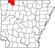 | |
| Towns | ||
| Townships | ||
| Unincorporated communities | ||
| Ghost towns | ||
| Footnotes | ‡This populated place also has portions in an adjacent county or counties | |
36°22′05″N 93°29′47″W / 36.36806°N 93.49639°W
| International | |
|---|---|
| National | |
| Geographic | |
| Other | |